September 8, 2014
Court Confirms Border Between Maryland and Virginia is Changing
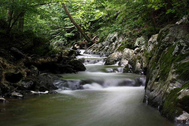
The boundary between Maryland and Virginia has been the subject of legal disputes for hundreds of years. On August 29, 2014, the Maryland Court of Special Appeals added another chapter to this “meandering” tale. The Court issued an opinion in a dispute over rights to certain waterfront property near Harper’s Ferry, West Virginia. River Riders, Inc., is a fishing, tubing and rafting tour company doing business in the “Potomac Wayside” area (pictured) along the southern bank of the upper Potomac River. Potomac Shores, Inc. claims the Potomac Wayside tract through their Washington County, Maryland, deed describing the south side of the Potomac as a boundary line. Potomac Shores asserts the parcel is in Maryland, because that geographic area was in the Potomac River before gradual accretion of the shoreline. From Potomac Shores’s perspective, that accretion is their windfall, not River Rider’s. Potomac Shores brought their title lawsuit in Washington County, Maryland. River Riders moved to dismiss on the grounds that the Potomac Wayside land is located in Loudoun County, Virginia, not Maryland.
I became interested in Maryland history during my undergraduate years in Annapolis. In 1996, I had a summer internship with the National Park Service in Sharpsburg, a small town in Washington County, Maryland. Harper’s Ferry remains one of my favorite day excursions, a beautiful spot where the Shenandoah River flows into the Potomac. This is where Maryland, West Virginia and Virginia meet. Along the Maryland side, the C&O Canal towpath offers a flat, scenic hiking and biking trail. Certainly an attractive area for entrepreneurs to base a river tourism business.
The historic Maryland-Virginia border disputes cover a spectrum of issues. Before this latest Maryland lawsuit, most disputes focused on use of oyster beds in Bay tidal areas. The passion for shellfish amid confusingly defined property rights repeatedly escalated into violence between Maryland and Virginia watermen. In 1874, Maryland and Virginia agreed to submit the boundary dispute to arbitration to resolve the matter peacefully.
The Potomac River is part of Maryland and the state boundary runs along the low-water mark on the Virginia side. What happens when this line moves? The Maryland Court of Special Appeals articulated the legal question as follows: “Does the boundary between Maryland and Virginia shift as the south bank of the Potomac alters because of time and the forces of nature? Or is the boundary fixed and immutable?” Potomac Shores argues that the boundary was set in the past and the gradual process of accretion, erosion and relection resulted in “new” land formed on the south bank of the Potomac.
Note that it has long been settled that the Potomac River is freely navigable by the citizens of the states, and that the waterfront property owners have rights to build docks and wharfs out into the river, as permitted under land use restrictions.
The conclusion reached by the Maryland Court of Special Appeals runs contrary to our modern preference towards “precision.” The Court rejected the “fixed boundary” approach requested by Potomac Shores. The Court upheld the Circuit Court decision, finding that, for the non-tidal portion of the Potomac River, the boundary shifts as time and the forces of nature gradually re-shape the low water-mark of the river’s “southerly shore.” This implies that the border between Maryland and Virginia is changing, by acts of nature, not government. This also means that those private landowners along the Maryland-Virginia border also have potentially shifting boundaries. Virginia’s Potomac waterfront landowners above Washington, D.C., may loose or gain waterfront property as the currents withdraw, add or relocate the shoreline.
The court’s decision avoids the problem of defining the water line boundaries as those that existed at a certain point of time in the past, such as a land grant or other legally significant document.
The new court opinion observes that the result of the case may be different if the accretion of the Potomac Wayside property was man-made. The opinion does not discuss waterfront landowners planting vegetation, constructing sea walls and laying rip-rap to protect their properties from natural change.
The Court analogizes state boundary lines and individual property boundary lines, quoting Justice Kennedy’s dissent in an older Virginia v. Maryland boundary case: “No court acts differently in deciding on Boundary between states, than on lines between separate tracts of land.” For example, the arbitrators in 1874 observed that, “Virginia’s prescriptive use of the river’s south bank had changed the boundary to the south bank’s low-water mark for the course of the entire river.” What is prescriptive use of real estate? Professor Minor defined it in his 1908 treatise as, “based upon the presumption of a grant, arising after long-continued, adverse, uninterrupted, notorious, exclusive enjoyment of a right in the land of another, under a claim of title.” The presumption becomes conclusive after twenty years. Was the arbitrator’s reference to the doctrine of prescriptive easements appropriate? Or is it a red herring?
The border between Maryland and Virginia is changing – is your boundary meandering as well? If you are currently experiencing a dispute with one of your neighbors concerning a property boundary defined by a river, stream, lake or other waterway, consult with a qualified attorney in order to explore your options to protect your rights.
Case Citation: Potomac Shores, Inc. v. River Riders, Inc., 219 Md. App. 29 (Ct. Spec. App. Md. Aug. 29, 2014)(Koehoe, J.)
Treatise Citation: Raleigh C. Minor, The Law of Real Property, Sect. 108 (1908).
Photo Credit: Camera John via photopin cc (apparently taken at Potomac Wayside, Purcellville, Virginia)

